Four Days in Death Valley: Painted Hills and Hidden Surprises
After two full weeks of hiking the rugged Eastern Sierras, four days in Death Valley felt like a vacation from our vacation. Death Valley is humongous (3.4 million acres!) and we lazily explored the park, driving through its vast stretches accompanied by the Eagles and Jackson Browne.
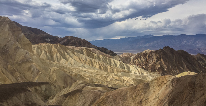
Though nature’s palette is muted here, it’s not limited to brown, brown, brown. I was delighted by the many Spumoni and Neapolitan hills of chocolate, pistachio, strawberry and vanilla; other areas showed off with fiery reds and oranges. We visited in October so flowers were few, but if conditions are right, a wildflower explosion in the spring adds splashes of yellow, gold, purple, pink and white.
There’s loads to explore in Death Valley; our four-day agenda logically organized around geographical areas to minimize driving. Before digging into details, here are a few broad notes:
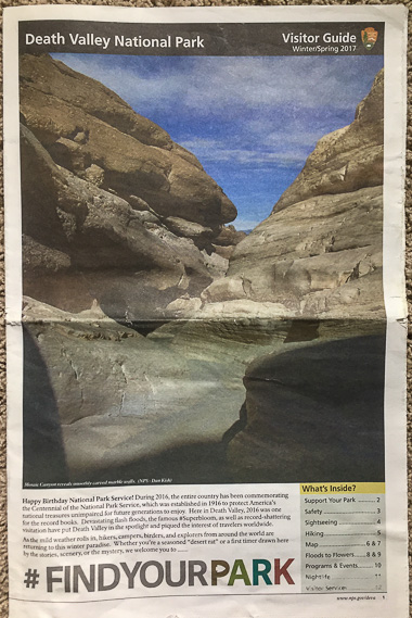
- Pick up a copy of the Death Valley Visitor Guide: This guide looks like a newspaper and is a wealth of information. It’s worth its weight in gold for the map alone - a huge full page spread that we referred to countless times. The newspaper is available at the Furnace Creek Visitor Center and other spots in the park, but since we approached from the west, we picked up a copy at the Eastern Sierra Visitor Center at the corner of US 395 and Route 136. It’s online as well: here are links to the Visitor Guide and a Death Valley map.
- Find out about ranger programs: Talks and guided hikes can add depth to park experiences. Check online for scheduled activities, pick up a schedule at the Furnace Creek Visitor Center, or call and ask for updated information (760–786–3200). We visited in October and when Karen passed through again three months later, they’d recently added ranger-led “Adventure Hikes.” Fun!
- Pay the park entrance fee: Fees vary, but when we visited, a 7-day pass for one car cost $25. Passes can be purchased at multiple locations throughout the park and from what I could tell, they largely rely on the honor system; support our national parks and pay the fee.
- Be prepared: Death Valley is an unforgiving environment with services few and far between; it’s not known as the “hottest, driest, lowest, wildest” for nothing. Carry plenty of food and water and have a paper map handy (cell phone service and GPS are spotty). As a park map notes, “Ninety-one percent of Death Valley National Park is designated wilderness, preserving opportunities to experience solitude, natural quiet, dark night skies, and wild nature. With solitude comes isolation, so you must be self-reliant for your own safety.”
- Give your car a once-over: Make sure your car is in good working order; a breakdown can be costly and time consuming! The park service website additionally warns, “Travel on the park’s hundreds of miles of backcountry roads requires the correct type of vehicle for the road conditions, a vehicle in good repair with all necessary tools and replacement parts, and some knowledge of driving on rough dirt, gravel and 4-wheel drive roads.” Don’t worry, the most popular sites are accessible by most cars/RVs and are located off paved roads or require only short stretches on dirt/gravel.
Over four days we hit many of the most popular sights in the park and found a few surprises along the way.
Day one
We drove in from the west on Route 190, so Father Crowley Vista was a natural first stop before heading south on Emigrant Canyon Road to Wildrose Canyon. Little did we know it would define the day - we stayed at Father Crowley for almost 2 1/2 hours!
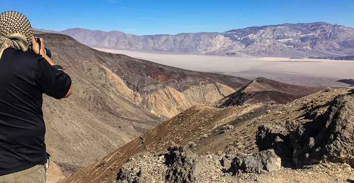
- Father Crowley Vista: This stop offers views of Rainbow Canyon and the Panamint Valley. It also provided one of the coolest “found moments” ever! Karen and I drove from the main parking lot out the dirt road to Father Crowley Point. As we walked towards canyon edge, loudly debating the merits of hiking on vs. off-trail, we came upon a guy camped out in the rocks. I apologized for making so much noise, and he replied “Oh don’t worry, I’m waiting for something much louder than you to come along.” Wait, what? We patiently waited for a couple hours and were rewarded with six different F–18 fly-bys in the canyon below. Insane! Apparently fighter pilots from nearby China Lake refer to Rainbow Canyon as Star Wars Canyon and the Jedi Transition. To see close-ups of the jets, visit the Explorers of the Mojave Desert Facebook page and search for “Star Wars Canyon”. Check out this video to see the route from a pilot’s perspective (skip to 9 minutes in).
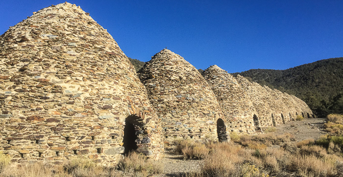
- Wildrose Charcoal Kilns: Love these! Built in 1877 and operating for just a couple years, the kilns made charcoal for the Modock Mine smelter. It was a slow process, taking up to two weeks to turn pinyon logs (four cords in one kiln) into charcoal. Be sure to go inside at least one of the ten kilns and stomp, clap or holler - the acoustics are phenomenal.
We’d planned to hike to Wildrose Peak but I didn’t have the energy so opted for a quiet evening talking to other campers at Wildrose Campground, playing Yahtzee, and admiring the evening stars. This dusty campground is pretty remote and has no view, but the price is right (free!).
Day two
Day two centered around Stovepipe Wells, and due north in Titus Canyon.
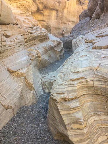
- Mosaic Canyon hike: Though the literature says this is a 4-miler, we did 4.4 with a side hike (on the return, the first canyon on the left). From my highly technical notes: “Fave! Pretty stripe-y rock, polished granite/quartz-y rock, multi-colored aggregate, and nice scrambling.” One benefit of getting out early: it was lovely to experience the ever-changing morning light. The hike took us two hours, and though it wasn’t very hot, I was glad for my hat, sunglasses, sunscreen, lip balm, and backpack with water and snacks.
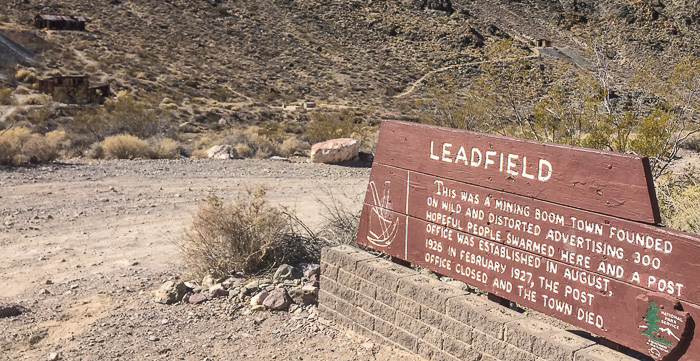
- Titus Canyon drive: Don’t attempt this crazy drive without a sturdy, high clearance vehicle! This 27-mile scenic drive through Titus Canyon took us three full hours end to end. Expect to drive slowly along a twisty, one-way dirt road with potholes and unguarded dropoffs. I was nervous in a few spots, but what a drive! Red Pass, Leadfield ghost town, petroglyphs, and the Canyon Narrows were highlights. Five cars caught up to us at Leadfield; we made sure to leave first to stay ahead of their dust-storm.
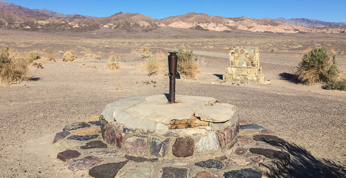
- Stovepipe Well: This spot was once the only known water source on the Cross-Valley Road. As the story goes, the well was repeatedly buried by sand so they stuck a stovepipe in it so people could find it.
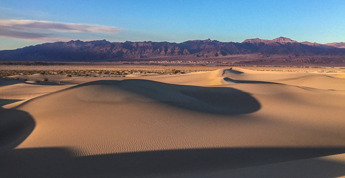
- Sunset hike at the Mesquite Flat Dunes: Another popular activity, but the dunes are plenty big enough to find solitude; even if the parking lot area is crowded, the furthest dunes can remain untouched. We hiked to a peaceful spot and stayed for close to two hours, mesmerized by the brilliant sky and growing shadows.
We ate dinner at Stovepipe Wells Badwater Saloon (average, but nicer ambiance and more interesting menu than the Corkscrew Saloon) and camped at the Texas Spring campground ($16/nt; found a nice spot in the upper area after giving up on our first choice and carrying the already-put-together-tent up the hill in the dark - ha!).
Day three
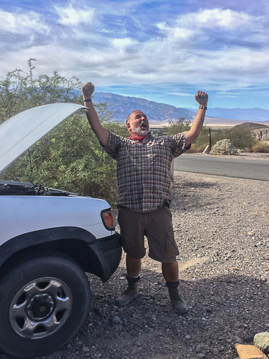
Remember those warnings (above) about cars and breakdowns? Well…we woke up to a dead car. Nooooooo! There’s one mechanic in Death Valley (at Farabee’s Jeep Rentals) but he was swamped with a big event. Our camp host kindly offered to take a look - a few different times - and somehow, magically, after six long hours, the car started. Whew! At 2:30pm we finally got on with the day, exploring sights between Furnace Creek and Badwater Basin.
- Furnace Creek Visitor Center: With our late start, we zipped through the displays describing the history, geology and ecology of Death Valley. There are many short movies throughout, and no matter the topic, each one held warnings of the many dangers in the area (kind of comical with repetition, but they make their point). I appreciated the main movie, narrated by Donald Sutherland, which explained how the mountains and valleys were formed. This stop is a great opportunity to talk with rangers and find out what’s happening in the park.
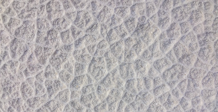
- Badwater Basin salt flats: We had to visit this spot (the lowest in North America at 282 feet below sea level) since just four days before, we’d climbed to Mt. Whitney’s summit at 14,505 feet (the highest point in the contiguous United States). The area was inadvertently named by a surveyor who marked the map as having “bad water” after his mule wouldn’t drink. Although the extensive salt flats seem truly “flat” from afar, close-ups reveal a complex network of geometric patterns.
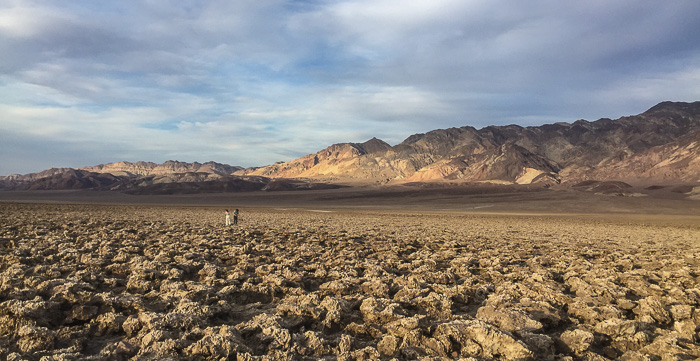
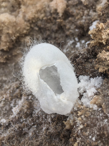
- Devil’s Golf Course: Take a few minutes at this site, so named because only the devil himself could play golf here. Stand quietly to hear a faint metallic ticking (like the sound your car makes as it cools down) - that’s from salt pinnacles expanding and contracting. And carefully wander a bit; you might be lucky enough to find delicate salt formations hidden amongst the crags.
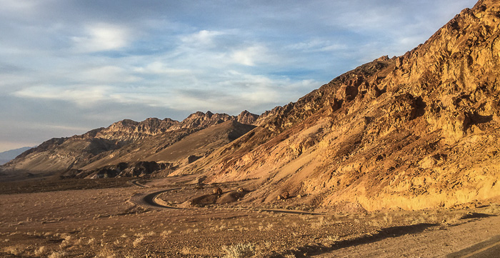
- Artist’s Palette drive: This 9-mile drive isn’t nearly as dramatic as Titus Canyon but far more accessible (on paved road!) and quite pretty, winding through multi-colored hills. From Visitor Center info: “The greens and blues are chlorites; the pinks and purples are manganese oxides; and the reds and oranges are iron oxides.”
For dinner, we had popcorn and pizza at Furnace Creek’s Corkscrew Saloon and watched the Cubs beat the Dodgers (woot!). It was a short drive to the Texas Springs Campground for a second night at the same campsite.
Side note: The car behaved all the way to civilization (in our case, Las Vegas) where the starter went out. We dodged a bullet; folks told horror stories of visitors spending thousands to be towed out of the park. Vegas is a much better place to deal with car issues!
Day four
Our final day. Since we’d eventually head east on Route 190 to Las Vegas, Zabrinskie Point and Twenty Mule Team Canyon were right on the way.
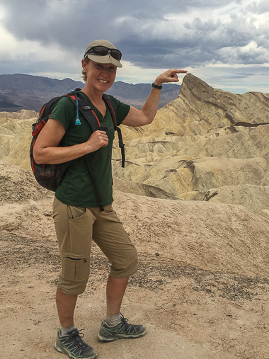
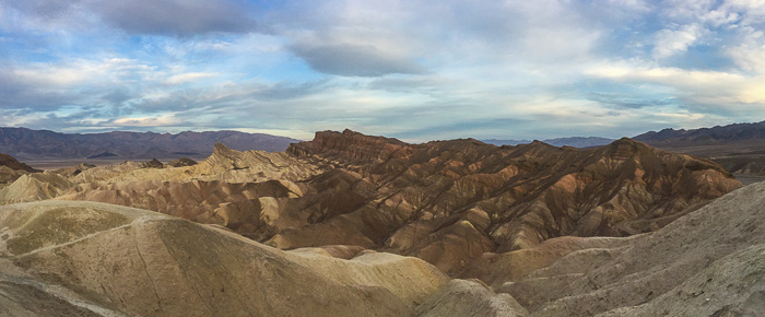
- Zabrinskie Point: This iconic viewpoint offers a breathtaking panorama with colors ranging from burgundy, mauve and pink, to gold, honey, cream and taupe. According to signage, hot water was responsible for, “…hydrothermally altering the rock into the psychedelic swirl of colors on the hills beyond.” Gorgeous.
- Badlands, Gower Gulch, and Golden Canyon Loops, with side hike to Red Cathedral: My favorite hike! You can do shorter loops, but we did a combined hike from Zabrinskie Point along the Badlands Loop, through Gower Gulch, up Golden Canyon, out to Red Cathedral, and back along the northern side of the Badlands Loop. Online info says the complete circuit is 7.8 miles but Runkeeper clocked 8.4 miles; the extra makes sense since we went “Schollin’” a couple times, wandering off to explore side trails. This hike has it all: breathtaking views, colorful hills, rock scrambling (if you want it), and even some old mines. Highly recommend!
- Twenty Mule Team Canyon drive: Many rave about this 2.7-mile drive, but we found it rather average (probably spoiled by Titus Canyon and Artist’s Palette). The canyon was named after the famous Twenty Mule Teams used for borax mining, although teams may not have been used in this particular area (!).
Dante’s View is often described as “the most exceptional view in the park” but given the time of day and drive ahead, we skipped it - have to leave something for next time!
We never made it up to the Scotty’s Castle area, partly because the Castle is still closed after the big 2015 storm (projected to open in 2019) but mainly due to the long drive required.
Death Valley was so much more than I anticipated and I can’t wait to come back to continue sightseeing (Scotty’s Castle, Dante’s View, the Harmony Borax Works…) and hiking (Fall Canyon, Wildrose Peak, the Ubehebe Crater, …), perhaps in the springtime when wildfowers add an extra splash of color.
This article is one of many written about a 3-week road trip spent hiking and camping in the Eastern Sierras and Death Valley. To see all articles, check out this trip summary.
